Showing posts with label Tabernash. Show all posts

Tuesday, February 18, 2020

Deck 3 Overview – The Western Slope

So, it has been a while since I talked about the plan for the dream layout. And there is a reason for that. The morning of the Central Model Train show, we had flooding in the crawlspace accessed in the upper right hand corner of the drawing below. While there was no damage, we identified that the sump pump in the space had failed, and that some of the equipment in the crawlspace is in need of annual maintenance. Surprise!

The previous owner had not told us that the crawlspace items needed annual maintenance and thus regular access. So, it looks like I will need to rework the plans to allow easier access to this opening. Pity, I really liked how this plan had come together and had gone so far as to detail all the buildings, roads, water, and even signals into the layout. But alas, the next iteration will be even better.

In the meantime, I figure I can finish going through the plan as it stands now...or as it stood. 

Deck 3 - Western Slope Plan.
So, here is the western slope as modeled. From Winter Park, the line descends through Fraser and into Tabernash before exiting the layout to through the upper reaches of the Fraser Canyon and entering into the helix. The helix would provide access to staging, and would connect back to the mainline at Prospect Junction - allowing for continuous restaging and continuous running when desired.

Cameron Turner

Tuesday, January 21, 2020

Welcome to Tabernash!

Things continue to be very busy at the start of the semester, so I am trying to squeeze in a couple of quick posts. Today, welcome to Tabernash Colorado!

Tabernash is a small community at the western end of the Winter Park Valley. To the west, the main line enters Fraser Canyon. To the East, the grade steepens to 2% as the line runs up to the Moffat Tunnel. Tabernash is the site of a long siding, a reverse loop connected to a wye, and is currently a layover location for the Ski Train. In the past, Tabernash was also a helper location where engines were added for the run up to the Moffat Tunnel. In more recent times, these helpers were used as swing helpers, running all the way to Denver to provide braking on the eastern descent from the Moffat Tunnel.

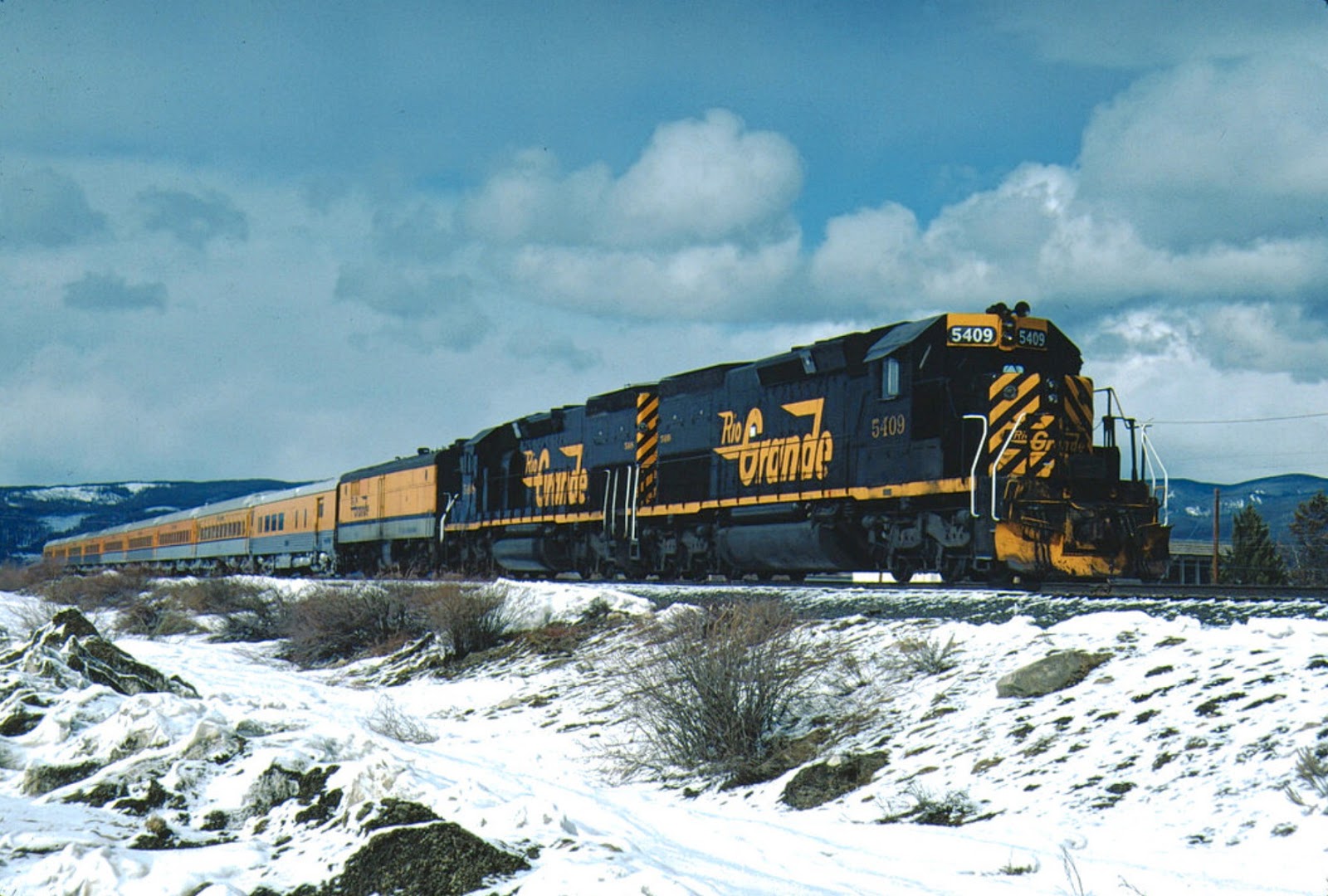
Eastbound DRGW 5361, 5369, 5358, 5370, and 5368 lead a coal train east out of Tabernash in November 1976. Photo from CarrTracks. 
 All of these make Tabernash desirable to include in the layout, if only to be able to model these different operational elements.

The Ski Train waits at Tabernash. Mike Danneman Photo.
The western end of Tabernash crosses a brief bit of ranch land as it enters Fraser Canyon. Here the main line is isolated from the road, making Fraser Canyon on of the more remote sections of the Moffat Line.

The siding wraps around Tabernash. You can see the freight on the left on the siding (old main), while Amtrak takes the new main on the right. Photo by Michael Harding.
To model Tabernash, I located it below East Portal, and above North Yard. The old main representing the siding wraps around the blob that contains the Moffat Tunnel Helix, providing a lot of length, while not lengthening the scene too much. The resulting siding is 216 inches long, making it the second longest siding on the layout to Rollins. Prototypically, it should be longer than Rollins, but the siding is long enough to hold any train I plan to run. I have added a pair of spurs to the town to allow for a team track and a local industry or two, just to have a little bit more operational capability.

Track Plan for Tabernash, CO.

Tabernash will reside almost 3 feet above North Yard, and given that there is only a little bit of operations there, I think it should not interfere too much with North Yard Operations. The nod-under at the wye for Tabernash will also have a clearance of more than 5 feet, so it will be a nod-under. However, its presence may also encourage folks to resist the temptation to pass into the North Yard area, and instead walk around the bookcases (representing the bottom of the aisle) to see their train from the Fraser Canyon end. Tabernash is also about 14 inches below East Portal, so there should be reasonable clearance between the two scenes.


Cameron Turner

Sunday, January 5, 2020

To Where the Ski Train Waits

Amtrak Station Sign at Fraser Colorado. Photo from Wikipedia.
Fraser Colorado (elevation 8574') often makes the news due to it being one of the colder spots in the continental United States. It is also the Amtrak stop for Winter Park, and hosts a short siding (length 4830') that is sometimes used to store the Ski Train prior to its journey east from Winter Park to Denver. The siding is too short to be useful for most trains, but passenger trains are another story.

The town of Fraser Colorado looking West. Photo from Colorado.com.
Fraser sits in a valley between mountain ranges in the Rockies. This is the typical terrain on the western slope; the DRGW ran through an obstacle formed by a mountain range, across a valley, and then through another obstacle. Often, you find a town at each edge of the valley and one in the middle. Generally, we find a siding at each location. Understanding this configuration is important from a modeling standpoint.

West of the continental divide, we see the towns of Winter Park (siding), Fraser (siding) and Tabernash (siding) after which the DRGW passed through Fraser Canyon. The Continental Divide and Fraser Canyon become the obstacles. This pattern is repeated as the line continues west. Exiting Fraser Canyon, the mainline encounters Granby (siding) crosses the valley of Grand Park (park is a term often used for these mountain valleys) to Hot Sulphur Springs (siding) and enters Byers Canyon. Again, exiting Byers Canyon, we have the sidings of Flat and Troublesome before reaching the town of Kremmling (siding) and Gore siding before entering Gore Canyon.

If I had the space to continue west, I would look at this pattern: Obstacle - Siding - Obstacle - Siding, etc. as a plan for the layout. But for the task of modeling the Fraser Valley, specifically for Ski Train operations, I had to look at this pattern differently. Winter Park is needed since this is where the Ski Train stops to let the skiers disembark. Fraser is where Amtrak stops. Tabernash is where the Ski Train is turned and often lays over in the siding during the day, although Fraser is sometimes used once Amtrak has cleared the area. I did consider combining Fraser and Winter Park, or combining Fraser and Tabernash as an alternative, but ultimately decided to model all three.

Track Plan for Fraser.
My model of Fraser captures some of the town and the siding (83 inches long, sufficient for about a 12 car passenger train with 4 engines) and the spur track that served a lumber facility. I plan to place a small sawmill on the spur that is being used to process trees killed by the bark beetle infestation in the area. I also added a spur off the team track that can be used as a team track for the town.

Travelling the Fraser Valley.
Continuing across the Fraser Valley, the scenery is limited. There is a crossing of Saint Louis Creek, but otherwise it is ranch land. Since the track will run along a narrow shelf, this kind of "nothing-to-see-here" scenery should give a feel of separation. I did decide to place a lake or pond near the western end of the scene as a few bodies of water began to appear as the line approaches Tabernash. These features are often created by low spots flooded by the Fraser River which the line will follow through Fraser Canyon.

The Ski Train crosses the ranch lands west of Fraser. Photo from Tom Brynas.
Cameron Turner