Monday, January 30, 2017

Ghosts of Tennessee Pass

I didn't really start railfanning until the early 1990s. One of my first spots I visited was Tennessee Pass. And it was a good thing I did, because only a few years later Tennessee Pass fell silent. I regret that I only visited about 3 or 4 times, but most of those times were full of action. I had been fortunate to see the pass earlier in my childhood with my father, and even eat in the Turntable Cafe in Minturn. I do remember seeing the helpers in the yard, and the trains leaving for the pass, but I honestly didn't realize how rare what I was seeing would become.


So, I've seen the pass go from solid Rio Grande, to Rio Grande/Southern Pacific to Southern Pacific/Union Pacific and to silence.

The western side of the pass begins at Minturn. Minturn is a helper town just west of Vail. Vail is now rapidly growing into Minturn. To the west, is the Eagle River valley, and a number of local industries that would be nice to include in any model. These towns run all the way to Dotsero, where the Moffat line joins up.

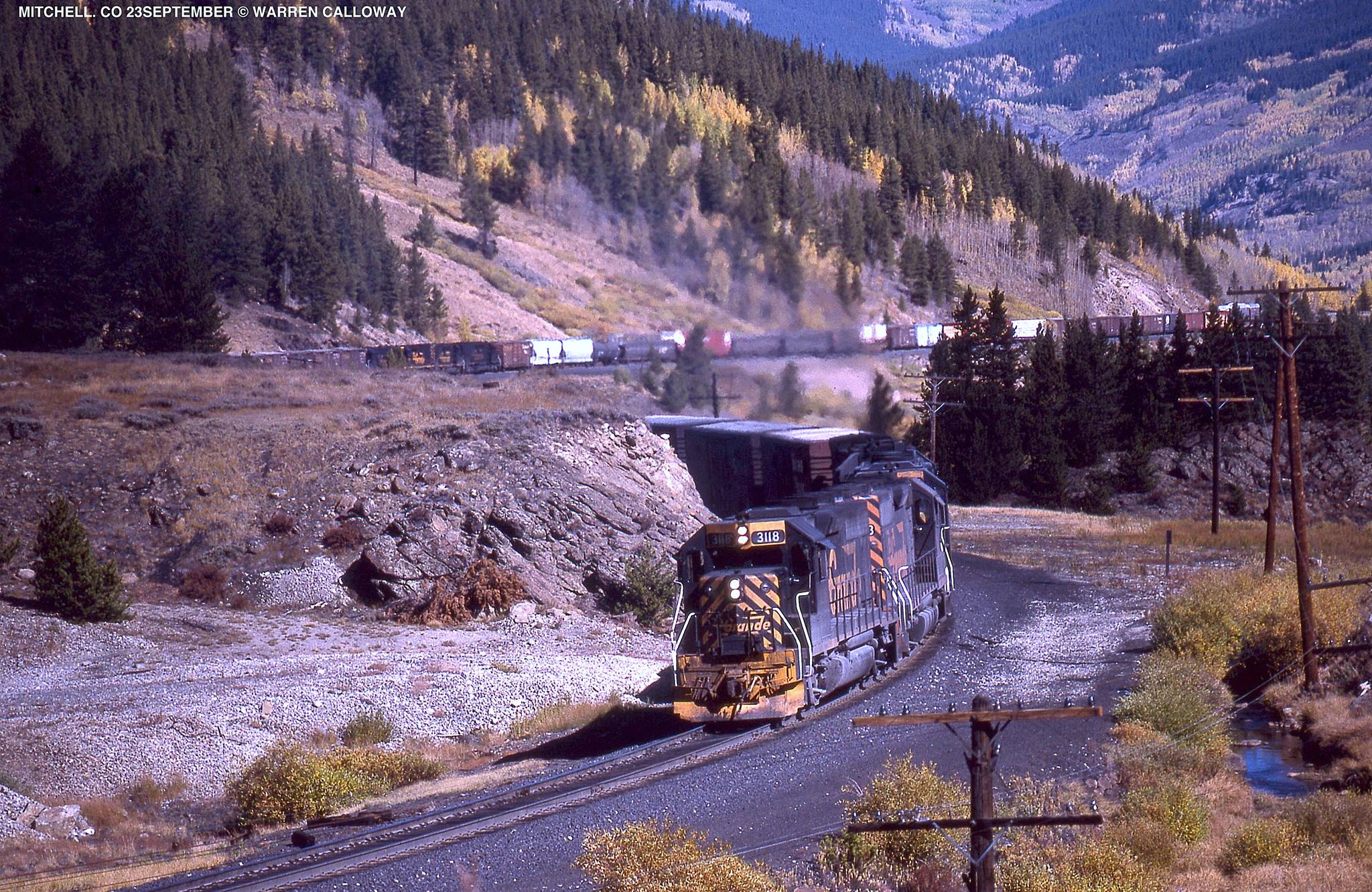
East of Minturn, the line begins a climb with grades of up to 3%! Trains with 8, 10, 12 or even more units climbed this grade. No wonder that UP retired the line. The initial part of the line slips through a canyon, past the now abandoned New Jersey Zinc Mine (and Superfund site) located with Belden siding, and the little town of Red Cliff, before climbing out of the canyon at Pando. At Pando, we have another passing track, and then Dean or Pando Tunnel. Finally, the train makes its last assault on the pass with the Mitchell Curves before reaching the summit tunnel.

Helpers usually ran on through the tunnel and were cut off at Tennessee Pass siding, or Malta siding on the other side of the pass. They might run back light, or swing onto another train struggling to surmount the 10,000 foot pass. Malta siding is also the connection to Leadville, or at least it was, along with a connection to an isolated piece of Colorado and Southern trackage (operated by the Burlington Northern) that ran up to the Climax mine, high on Fremont Pass. 

Continuing East from Malta, the line follows the Arkansas River, through towns such as Buena Vista, Nathrop and Salida. The line passes through the scenic Brown Canyon, past a beautiful bridge near Princeton siding (which begs to be modeled) and along the Collegiate Peaks of Colorado. Salida was once a division point, and was where the Standard Gauge and the Narrow Gauge met. IT was out of Salida that the Narrow Gauge 3rd Division left for Utah. But alas, the Narrow Gauge was removed, although the Monarch Branch was standard gauged and ran into the 1980s. This branch was unique on the Rio Grande, with a pair of switchbacks. Its operation is fascinating, and the subject of more than one book and video. Clearly, railfans loved the line.

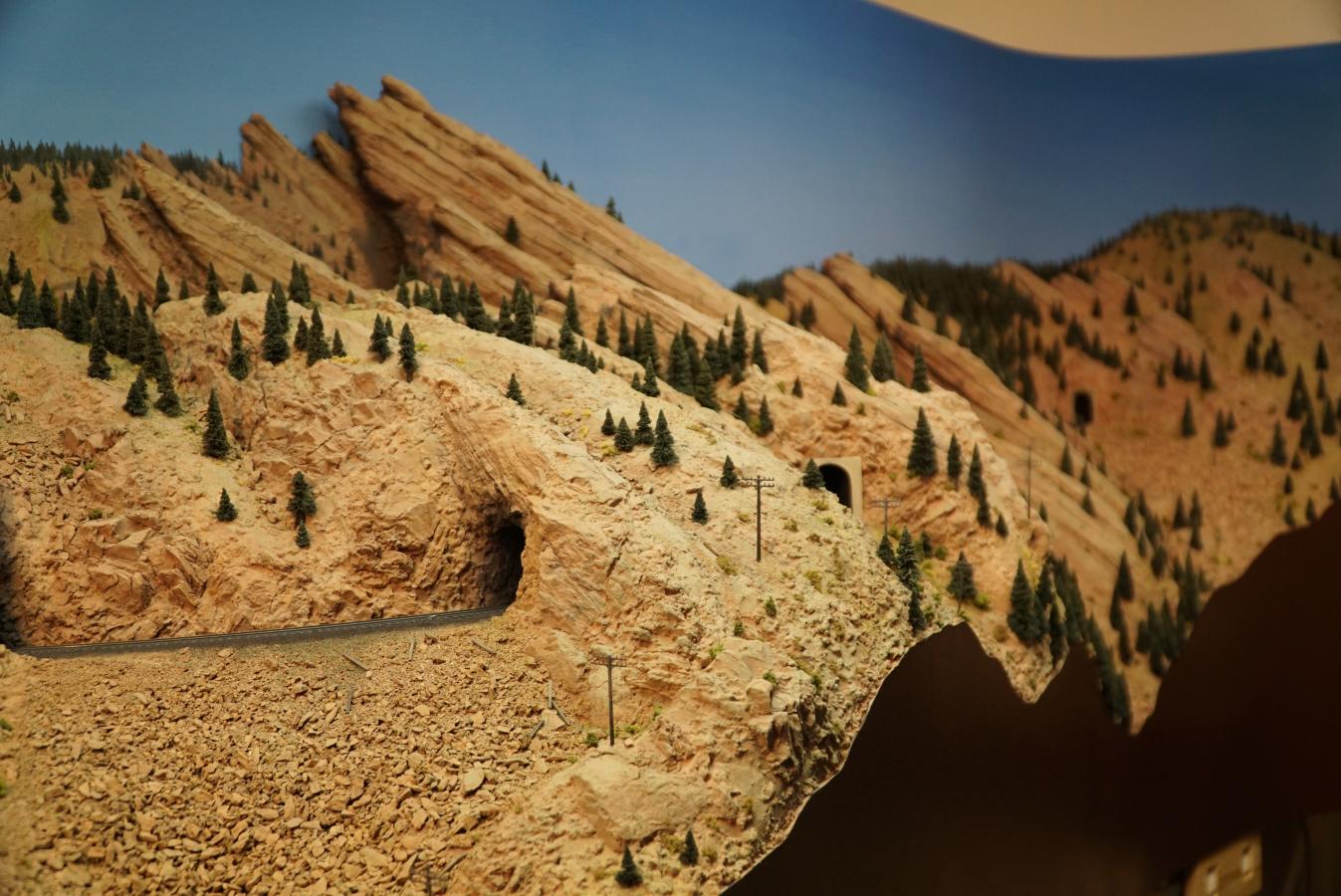
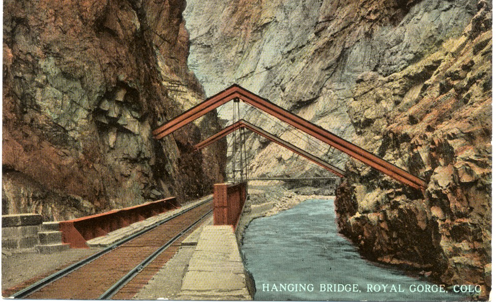
East of Salida, the railroad works through another canyon, passes sidings such as Spikebuck, Texas Creek, and Parkdale, before plunging through the Royal Gorge. Within the Gorge, you have the hanging bridge, but otherwise, scenes only scene by the white water rafters, or riders of the railroad.

The railroad emerges in Canon City. The stretch from Canon City to Pueblo is itself interesting. The Santa Fe had some access along this stretch to provide service to customers. There are switching opportunities in Canon City, Florence, and Portland. Portland hosts a major cement industry. In addition, there is an Gypsum Wallboard plant along the line. Before entering Pueblo, the line transverses some interesting and unique scenery as the climate becomes much more of a dry high plains topography. 

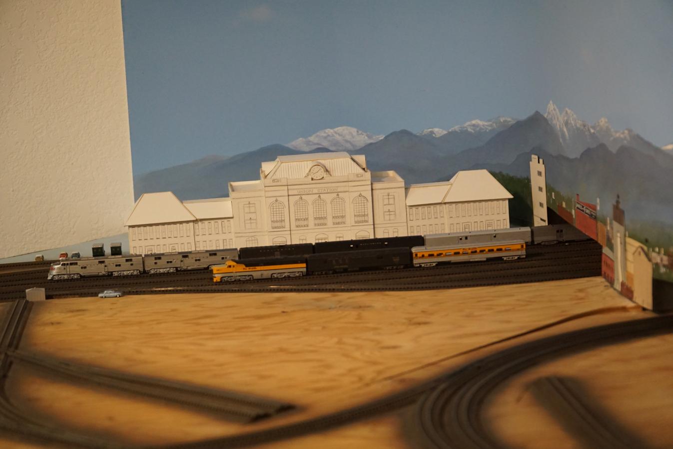
Pueblo itself is a major endeavor, with local industries, multiple rail yards, junctions between the Joint Line to Denver, the line south to Walsenburg and La Veta Pass, as well as Trinidad and Raton Pass. East, the Rio Grande operated the MP line to Kansas and ultimately to Saint Louis. The Santa Fe, Missouri Pacific and Burlington Northern both came into Pueblo. There is even a fantastic, iconic passenger station. Also of interest, just south or Pueblo is the Minnequa (Colorado Fuel and Iron) Steel Mill, which even boasted a narrow gauge plant railway at one point. There are several power plants nearby, and north of Pueblo is Fort Carson if you like military trains.

All in all, the subdivision runs about 230 miles. It is a lot of railroad. The grades on the eastern side are much less than those on the western side, but are still significant. So, massive freight trains, even inter-modal trains plied the line. Double stacks, while rare could transverse the line since the tunnels were not as restrictive as those on the Moffat line. However, passenger service (even Amtrak) has been non-existent since the 1960s. So, the line is interesting and historically relevant. A fantastic model of the line has been built by Rob Carey (in N-scale). The line was also featured in Model Railroad Hobbyist Magazine and N Scale Railroading's May/June 2009 Issue.


I've never seen this layout in person. But it certainly is fascinating.

So, as I have done before, lets talk Operational LDEs:

  • Eagle River Valley Industries (W);
  • Minturn (W);
  • New Jersey Zinc Mine (W);
  • Belden siding (W);
  • Pando siding (W);
  • Malta siding (E);
  • Leadville Branch (E);
  • Salida (E);
  • Monarch Branch (E);
  • Parkdale siding and quarry (E);
  • Hanging Bridge (E);
  • Canon City/Florence (E);
  • Portland (E);
  • Pueblo Yard/Industries (E);
  • Pueblo Union Station (E); 
  • Junctions to other lines (E); and
  • Minnequa Steel Branch (E).

The Scenic LDEs include:

  • Eagle River Canyon (W);
  • Red Cliff (W);
  • Camp Hale (W);
  • Dean Tunnel (W);
  • Mitchell Curves (W);
  • Tennessee Pass Tunnel (W);
  • Mirror Lakes (E);
  • Princeton Bridge (E);
  • Buena Vista/Nathrop (E);
  • Brown Canon (E);
  • Salida Canon (E);
  • Royal Gorge (E);
  • Swallows siding (E); and
  • Goodnight (End of Double Track of of Pueblo) (E).

That is 17 operational LDEs, and 14 scenic LDEs that I would prioritize in the layout. 5 of the operational LDEs and 6 of the scenic LDEs are on the west side. Clearly, the eastern side of this line is much more demanding than the western side. But of course, that also depends on the fidelity of the layout plan too. Extending the western side to include Malta and Leadville adds 2 more operational LDEs, and maybe 1 scenic LDE, so you could quite conceivably model the west side in a reasonable area. Extending to Salida, adds 2 more operational LDEs and 3-4 scenic LDEs. Again not unreasonable. But there is a lot of "good stuff" near Pueblo operationally, even if the scenery is less compelling (6 operational LDEs and 2 scenic LDEs between Pueblo and Canon City).

Sunday, January 29, 2017

Backtracking

I really liked how I worked in the Operational and Scenic LDEs in my Craig Branch concept post. So, I decided to go back to the Moffat Concept Post and do the same.


Operational LDEs:

  • Denver's North Yard/Cargill/Utah Junction - Main classification yard for the layout and origin/destination of the locals out of Denver (E);
  • Denver Union Station/Prospect Junction - Signature passenger facility (E);
  • Leyden Siding - Often used to hold trains until there is space in North Yard. North Yard switch crews can also bring trains in from Leyden (E);
  • Rocky Siding - Junction to the Rocky Branch (E)
  • Rollins - major siding on the eastern portion of the line (E);
  • East Portal - Moffat Tunnel location and railroad operations center (E);
  • Winter Park - Ski Train destination (W);
  • Fraser - One of the few switching locations on the line (W);
  • Tabernash - Turning point for the Ski Train (W);
  • Granby - Amtrak stop (W);
  • Kremmling - Switching location (W); and
  • Bond - Junction with the Craig Branch and crew change point (W).


Scenic LDEs:

  • Big 10 curves including Rocky and Clay sidings (E);
  • Coal Creek Canyon and Tunnel 1 (E);
  • Plain Siding and Rainbow Cut (E);
  • Selection of Tunnels 2-8 (the Flatirons Tunnel District) (E);
  • Selection of Tunnels 10-18 (Lower South Boulder Creek Tunnel District) (E);
  • Crescent Siding (E);
  • Selection of Tunnels 19-27, and 29 (Upper South Boulder Creek Tunnel District) (E);
  • Cliff Siding (E);
  • Tunnel 30 (E);
  • Tolland School House (E);
  • Fraser Canyon (W);
  • Byers Canyon (W);
  • Gore Canyon (W);
  • Little Gore Canyon (W); and
  • Yarmony Tunnel (not actually on the subdivision, but a bridge and tunnel scene just west of Bond)(W).

There are a lot of elements, but if you look at the East versus the Western parts, perhaps a more feasible layout emerges. On the eastern half, preceding the Moffat Tunnel, there are 6 operational LDEs and 10 scenic LDEs. On Mike Danneman's layout, he models 4 of the 6 operational elements, and 8 of the 10 scenic elements. Dropping Leyden simply means that trains hold at Rocky instead, and Rollins, Cliff and East Portal are really rolled together. Thus, Tunnel 30 (between Cliff and Rollins) and the Tolland Schoolhouse (along with its siding) between Rollins and East Portal are dropped as well. Perhaps this is why I really like his plan.


The western half is less extensive - 6 operational LDEs, and 5 scenic LDEs. However, the operational elements are less substantial than those on the eastern end. Nonetheless, it is a little more of the scope of Danneman's beautiful layout.


Saturday, January 28, 2017

A Focus on Coal

Any layout based on the Craig Branch would be focused on its primary traffic...Coal. Lots of Coal. Crews of the coal trains pick up their trains in Phippsburg, take them to the mines and return the train to Phippsburg. Both East and West of Phippsburg are two summits, Toponas to the East and Pallas to the West. Since crews change at Phippsburg, it seems that most models of the branch would be centered around Phippsburg. Fortunately, just east of Phippsburg is a signature scene on the line, Finger Rock.

Further East, the line passes through Yampa, Colorado before cresting Toponas Summit and then descending through Energia Canyon and Rock Creek Canyon enroute to Bond. Both canyons are spectacular scenic features, but essentially inaccessible. However, the line does possess several steel trestles (a rarity on the D&RGW), and multiple tunnels.

West of Phippsburg, the line climbs to Pallas Summit, before descending past the Edna Mine complex, inspiration for the Walthers New River Mine Kit, through picturesque Steamboat Springs, and on the the end of track at Craig. Several branches depart to various coal mines en route. The land becomes increasingly range land, and several switching opportunities exist around Craig. The primary non-coal traffic on the line is a once a week local to Craig, crewed out of Phippsburg.

A very interesting plan for a Craig Branch focused layout was designed by Bernie Kempenski and published in Model Railroader's Mid Sized Track Plans for Realistic Layouts. I am a big fan of his modeling and layout plans. His track plan captures Rock Creek Canyon, Phippsburg, Craig and one of the coal branches along the line. For its size, it is a nice plan which would be fun to operate. However, I worry that the limited traffic of this line might ultimately lead to boredom. A more complete model of the line would add interest with additional mine runs, and more extensive helper operations. A little modelers license could add some additional industry along the line, particularly for agricultural and oil and gas operations. The addition of a "Ski Train" to Steamboat Springs could add further interest. But really, to get a wide variety of operations, extending the model to include Bond and the Moffat main line is important in my eyes. At least then, a parade of trains through Bond could be modeled, while operations would focus on the branch activities. I've actually operated on a very nice layout that modeled a short stretch of mainline, with plenty of through traffic, but which had operations focused on local trains that ran off the main to several branches. So it can be done. What would my representation of the Craig Branch look like? Let me try to lay out the concept.

I'm very fond of the concept of Layout Design Elements (LDEs) coined by Tony Koester. Another railroad author of whom I am a big fan. However, I separate them into two types - operational and scenic. Operational elements exist to support model operations, while scenic elements exist for the purpose of providing visual separation between operational features. Such elements are essential for the operators to give a sense of distance and to provide time between operational stops. In this concept, I think the following Operational LDEs should be represented:

  • Phippsburg - crew change point;
  • Craig - Main switching location;
  • Bond - Main line Junction and Main Line Crew changes;
  • Volcano Siding - the only siding on the branch where two coal trains can pass;
  • Edna Mine - now long gone, but it is such a signature element I would want to include it;
  • Steamboat Springs - Possible second switching destination, passenger destination;
  • Yampa - Possible third switching location; and
  • Branches - Ute, Energy, Empire and Axial branches all come off the Craig Branch, and one or more should be included.

What about the Scenic LDEs? I would try to include:

  • Finger Rock - Near Yampa/Phippsburg, a signature scene;
  • Toponas Summit - the major summit on the line;
  • Pallas Summit - the second summit around Phippsburg;
  • Energia and Rock Creek Canyons - these areas bracket the isolated Volcano siding;
  • The Climb out of Bond - two tunnels and a horseshoe known as Copper Spur; and
  • McCoy/Crater Loops - a scoria rock operation between Rock Creek Canyon and the climb out of Bond.

Is it do-able? Maybe. The concept does have the advantage of requiring a much smaller operational crew. Is it worth doing? Perhaps...

Wednesday, January 25, 2017

Why the Moffat Line?

The Moffat Line follows the old Denver and Salt Lake Route from Denver through the Moffat Tunnel, past such notable stops as Winter Park, Granby and Kremmling, to Bond, Colorado. At this point, it meets the Dotsero cut-off to connect to the original D&RGW mainline just before Glenwood Canyon. But from Bond, the original route headed towards, Yampa, Phippsburg, Steamboat Springs, and ultimately ended at Craig, Colorado, short of the original Salt Lake City goal.

http://i12.photobucket.com/albums/a218/RailwayChildrenBobbie/moffat.jpg

The line is operated as two divisions in the modern era. Crews run from Denver to either Bond or to Phippsburg. Furthermore, Phippsburg looks like a visible staging yard with empty coal trains heading up the branch to Craig for loading, or loads ready to go to Denver. The scenery on the line is amazing, ranging from plains, to foothills, canyons, and mountain valleys, ranging from alpine regions to much more arid range lands. There are numerous scenic wonders to model. Further, the operations are interesting.

If one looks at much of the line, it is about moving traffic. The typical arrangement on the western side is for there to be a geographic obstacle such as a canyon, followed by a passing siding, a trip across a mountain park to the local major town (with a siding) followed by the rest of the trip across the mountain park and another passing siding right before the next obstacle. It is easy to see how this could be easily compressed to an obstacle-siding/town-obstacle format. On the eastern side, this is already the case, with the exception that the towns are typically more a collection of a few houses.

Yet, there is also some local traffic, particularly out of Denver. Denver connects to the Belt line, which can support as many as five local switching jobs to the North and East of Denver. An additional switching job runs to South Denver, and there are transfer runs to the recently closed Burnham Shops, and the central Denver industries. There used to be a run to the Association Line in West Denver (now the route of a Light Rail line), and the Rocky Local which runs out to a branch at the base of the foothills. There are some industries along the line as it heads west out of Denver, but the line is also shared with traffic to the BNSF Golden Branch which primarily sees Beer Trains to Coors Brewery in Golden.

But all of these are on the east end of the line. East of the Moffat Tunnel, once you are past Rocky Siding where the Rocky Flats branch leaves, there is almost nothing. Plain siding seems to occasionally get some supply cars for MOW crews working up the line. Pinecliffe appears to have the remains of a team track which could be restored in the model to provide a little traffic. Rollinsville also appears to have a team track arrangement, and there is definitely some activity at East Portal, including a large building with two tracks running into it which I have not been able to find its purpose. Anyone know?


West of the tunnel, things get a little better but not much. There are a few spurs in Fraser, Granby, Tabernash, and Kremmling, but really very little. Consequently, once you are west of Denver, past Rocky siding, almost all of the trains are through trains. This makes the vast majority of the route a dispatcher's railroad. The engineer's portion is really focused between Denver and Rocky, and then there are really only switching jobs outside of the yard if this area is given the space to be modeled. Now, I like the Dispatcher aspect, and the line is complicated with the use of Swing Helpers. Often helpers are added at Bond or Tabernash to Eastbounds, and run with the train to Denver. Trains out of Denver get helpers that run the opposite route. There are not many helpers that are cut off and return to either location. In addition, you can have passenger traffic, as the line hosts Amtrak, the Skit Train, and various excursions such as the American Orient Express.

There is a lot going for this route - and that is obvious when you look at some of the existing model railroads of this route. Brian Holtz had the Panaramic Division in Model Railroader in the 1980s, Doug Tagsold modeled this route, eventually giving even more layout space to the Denver Belt Line than he had originally, and then there is Mike Danneman's Moffat Route, which is an artistic masterpiece. If you have not seen it, you have not been paying attention as it has made both Model Railroader and is a regular in N-Scale Railroading.
http://www.nscalerailroadn.com/005/NSR005.html

Video Slide Show of Mike Danneman's Layout

You have to see his layout in person to believe it. It is artistic beauty. I've been inspired by it since the original planning article in NSR (Issue #5 May/June 2001). I love Mike's layout and his talent, but he models 5 of the 9 sidings between Denver and the Moffat Tunnel's East Portal. Consequently, the operations potential for locals out of Denver is limited. I have to wonder if I can do better in my space? Can I get even some of the spectacular scenery without sacrificing as much operations potential as I think Mike had to in his space? Furthermore, knowing Mike's spectacular layout is out there, anything I do would get compared to it, and would that bother me? I've met Mike personally, and think the world of his talent, both in the model world, but also in the photography world. He is well worth following on Flicker under the handle Moffat Road. So, is this the route to take with my modeling...there are lots of good reasons to go down this track...

Until next time...


Tuesday, January 24, 2017

Starting the Journey...

http://www.corailroads.com/2013_12_01_archive.html
I grew up in Colorado, down the road from the Big 10 Curves, the Tunnel District and the Moffat Tunnel. I camped on Tennessee Pass, ate in the Turntable Cafe, and watched the Denver and Rio Grande Western roll through Glenwood Canyon (pre- I-70). I road the Durango and Silverton in 1982, remember seeing coal trains through Steamboat Springs, and later discovered Soldier Summit, the hospitality of Helper, and the beauty of the Utah desert.

I guess it makes sense that when I chose a road to inspire my model railroading, the Rio Grande was high on my list. I used to live in Colorado, but having left that state, I find my mind returning to memories of Colorado, and now that I have space for a layout, an understanding spouse, and an agreement to build a layout in part of our basement and garage, I have decided to start this blog to share my thoughts as I depart on this grand journey.

So, what do I want in a layout?

Well, I want the layout to support operations, yet still capture some of the scenic beauty that I recall from my youth. I've been in N-scale for a couple of decades now, and so I have a fair amount of equipment in 1:160, and I have operated multiple layouts in N-scale, so I am convinced that it is feasible. I am sure I can make a better list than this.

My space is pretty good, but not huge. One room is about 300 square feet, but is constrained on two sides that will require access through the layout area. The other is about 450 square feet, but needs work before the layout can be installed, and also has two constraints requiring access on one edge, and in one corner. The two rooms can be connected by opening up a wall, but the resulting opening would likely be limited to 32" or less. Not ideal to pass an operator through, let alone an operator and a train. Furthermore, given the configuration, I would really like to build the layout(s) in 3 phases.

Phase 1 would be a smaller, self contained layout in the more layout ready of the two rooms.There is some remodeling work needed in the first smaller room, but depending upon the layout design, this task is very manageable. Ideally, this would produce a layout which could operate within a year or two while the space for Phase 2 is prepared.

Phase 2 requires a fair amount of prep work. There is some plumbing to move, a water heater to replace with an on-demand hot water system, a concrete floor to seal, a ceiling to install, and a wall to build to allow me to isolate and properly condition the space. I'm looking at Phase 2 as a bigger layout which could be built over a decade or so, but once "complete" and operable, I would have the option of extending it into the Phase 1 space.

Phase 3 would be that extension of the Phase 2 layout into the Phase 1 space. It is also possible that Phase 3 might be an extension into other existing space, but that is far from certain. No matter. At this time, the idea is to ensure that the Phase 2 design has the possibility of be extended into a third phase yielding my dream layout.

So, right now I am thinking about those options, for what may constitute my modeling focus in Phases 1, 2 and 3. And I have a number of ideas. Right now, I just want to offer a list:


  1. D&RGW Moffat Line (Denver to the Moffat Tunnel and Beyond)
  2. D&RGW Craig Branch (Bond to Craig)
  3. D&RGW Tennessee Pass (Pueblo to Minturn/Dotsero)
  4. D&RGW Soldier Summit
  5. D&RGW Belt Line
  6. Freelance "D&RGW-like" Line combining elements of the above
  7. D&RGW Marshall Pass Line (Nn3)
  8. RGS/D&RGW in Nn3 (Durango-Ridgeway/Silverton)
  9. Freelance Rio Gorre Northern in Nn3 (based on Colorado and Western NG lines)
  10. Colorado Central in Nn3 (Denver through Golden to Silver Plume/Central City)
  11. Wildcards...


That is 11 ideas, covering a lot of possibilities. Frankly, I am not sure what to pick. But I have some time to play with ideas before I can break ground on building the dream. I have a career goal that I promised my wife I would achieve before I start on this project, so right now I am limited to a bit of dreaming. But in those dreams, I want to explore these options and see what may yet come.

In my next posts, I want to layout my ideas in a bit more detail. Until then...